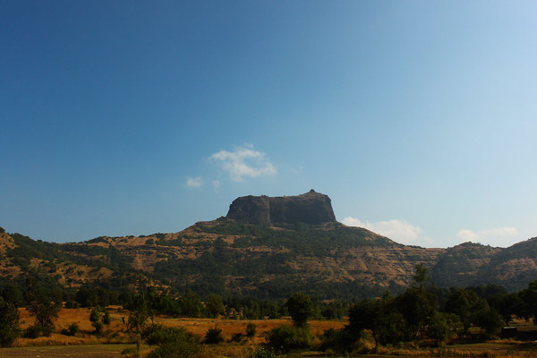
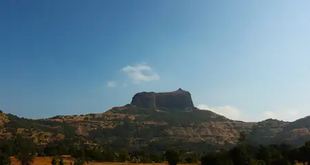
Maharashtra is blessed with beautiful hill forts in almost each and every district. All these forts have a rich history, and have become popular trekking and hiking destinations over a period of time. Harihar Fort or Harshagad is one such fort, nestled atop lush green hills of Sahyadri, also known as the Western Ghats. It is located 40 km from both Ghoti and Nashik City, 48 km from Igatpuri in Nashik district of Maharashtra. This important fort was constructed to look upon the trade route through Gonda Ghat, connecting Maharashtra to Gujarat. Today it attracts daring trekkers with its 80 degrees steep slope of intrinsic, peculiar-shaped rock-cut steps.
Before planning your trip or trek to the fort, go through the following facts and details. Here you will learn about the history of the Harihar Fort, along with its structure and detailed route of the famed trekking.
Harihar Fort: Information
|
Location |
Nashik, Maharashtra |
|
Nearest Railway Station |
Nashik Railway Station (56 km); Kasara Railway Station (60 km) |
|
Nearest International and Domestic Airport |
Chhatrapati Shivaji Maharaj International Airport, Mumbai (170 km) |
|
Type |
Hill fort |
|
Year of Establishment |
Seuna or Yadava dynasty in between the 9th and 14th centuries |
|
Height |
3,676 feet above MSL (Approx.) |
|
Material Used |
Stone, Bricks, Alkali |
|
Best Time to Visit |
October to February; June to August for Monsoon Trek |
|
Difficulty Level of Trekking |
Moderate to Challenging |
|
Risk Factor Grade |
Medium |
|
Base Village |
Harshewadi; Nirgudpada or Kotamvadi (300 meters from Nirgudpada) |
|
Trek Distance (One-way) |
· From Harshewadi – 2.5 km · From Nirgudpada or Kotamvadi – 3.4 km |
|
Trek Duration (One-way) |
· From Harshewadi – approx. 2 hours · From Nirgudpada or Kotamvadi – 2 hours 30 minutes |
|
Advised Age Group |
Generally 15-50 years |
Also Read: 14 Offbeat Places Near Mumbai For A Quiet Getaway
Harihar Fort: History
Harihar Fort lies in the Trimbakeshwar Mountain Range of Western Ghats. The establishment of the fort is dated back to the Seuna or Yadava Dynasty (between the 9th and 14th century). The fort was substantially important to safeguard the trade route passed through the Gonda Ghat.
Since its establishment, Harihar Fort was attacked and captured by various invaders until the British Army took over. This was one of the forts in the possession of the Ahmadnagar Sultanate. In 1636, along with Harihar Fort, the Trimbak, Tringalvadi and a few other Poona (now Pune) Forts were surrendered by Shahaji Bhosale to the Mughal General Khan Zaman. Harihar Fort was one of the 17 strong forts that were surrendered to the British on the fall of Trimbak in 1818, when all these forts were captured by Captain Briggs.
Harihar Fort: Structure
Captain Briggs has left a fairly detailed description of the Harihar Fort. Though most part of the fort could not stand the test of time, it still has an impressive structure. The access till halfway up is tolerably easy. Several paths from the foot of the hill unite there along with a reservoir and some wells. Some houses for the garrison were also there, which are no longer in existence.
The real ascent to the scarp begins here and is truly breath-taking with its dreadful steepness. The slope is perfectly straight for about 60.96 meters (200 feet), just like a 200 feet high ladder, set straight against a wall. But the steps are bad and broken at places. Holes are cut in the rock to support the hands, creating the peculiar shape of the steps.
At the top of the steps is a door, now partially dilapidated. Through the door, there is a walk under a rock-cut traverse, with no wall along the outer edge. After the gallery, there is the second flight of stairs. This flight is worse than the first, ending at a trap-door at the top, with only enough room to crawl through. This leads to a cave-like structure, finally opening to the vast field at the top with wonderful surrounding vistas.
From there, the highest peak is another 10-15 minutes ahead. Back in the day, the fort was well supplied with water and other facilities. Grains and other provisions were kept in a thatched house within the compound. The storage house is still there with a small entrance. There is a series of rock-cut water cisterns in the centre of the fort. Unfortunately, these do not hold portable water anymore.
A deep-down secret place is recently found by some trekkers, which was probably a jail or storage. This part of the fort can be reached through an old, broken and more risky trekking route.
Facts about Maharashtra Tourism You Should Not Miss
Harihar Fort: Trekking
The phenomenal thing about Harihar Fort Trek is that, it appears to be rectangular in shape from the base village. But the fort actually is built on a triangular prism of rock. The edges of the rock are vertical, which is the distinctive feature of this strikingly ancient fort. These vertical steps are the main attraction of the trek, which makes it the most iconic climb in the entire Sahyadri Range.
Harihar Fort Trek is short yet quite demanding. The last 200 feet of the hike is a nerve-racking climb, through those steep rock-cut stairs. The stairs are around 200 steps in total, and are inclined at 80 degrees. The descent is particularly exhilarating as you have to climb down and at one point face a sheer 500 feet drop. The architecture of the stairs is diverse and outstanding. It offers spectacular and occasionally scary views of the valley below.
Reaching the Base Village
The base villages of the Harihar Fort Trek Route are Harshewadi, Nirgudpada or Kotamvadi. The route from Harshewadi is easier and quicker than from the Nirgudpada.
The Harshewadi is 13 km from Trimbakeshwar. For reaching Harshewadi, you can reach Kasurli by boarding the ST bus of Igatpuri – Trimbakeshwar – Khodala. From Kasurli, you have to climb a small hill where Harshewadi is located. If you are travelling from Mumbai, you get on an express train from Mumbai CST to Nashik road. From there, just take a cab that will drop you at Harshewadi. Another option is taking a bus from Nashik to Trimbak, then a cab to Harshewadi.
For travelling from Mumbai to Nirgudpada, you can get down at Kasara or Nashik rail station. From Mumbai CST, you can get a local train every 15 minutes. From Kasara, you can get a cab to Khodala, another junction 30 km from here. From Khodala, you can get a private or share taxi to Nirgudpada. From Nashik, get a state transport bus to reach Trimbakeshwar, from there get a cab that goes to Nirgudpada. Another way to reach Nirgudpada from Mumbai is to reach Igatpuri by train. From Igatpuri, get into any bus that goes to Trimbakeshwar, via Nirgudpada. From Nirgudpada village, the exact location to enter the Kotamwadi village is opposite to the Harihar Dhaba, which is very close to Nirgudpada bus stop.
The Route
The entire route of Harihar Fort Trek can be divided into two sections-
- Base village to the plateau
- Plateau to the top through the vertical steps
Section 1-
The wide trail moves away from the Kotamwadi Village towards the Trimbak region bypassing the paddy fields. The trail starts gradually climbing up, after crossing the fields. It goes through a bushy forest until it reaches an open ridge. That ridge is connected to the fort. During the monsoons, several small streams can be found on the way.
After trekking on the same trail for a little while, you will reach the plateau. The trail from Harshewadi village also leads to here. The Harshewadi village trail begins by the side of a small lake and continues through a mixture of jungles and open clearings. It is a much shorter and simpler route than the Kotamwadi one.
Section 2-
From the plateau, the most challenging part of the trek, with the iconic vertical steps is visible. There is a small stall at the end of the plateau to refuel for the exciting and demanding trek ahead.
The fort is positioned at the top of the steep slope. The ascent through the 60.96-meter rock-cut steps is quite challenging. The steps are worn out in many places. So, notches on either side of the steps are conveniently carved in for holding onto. During monsoon season, the steps are very slippery.
There are around 90 steps before reaching the main entrance or the Mahadarvaja. After the entrance, the path takes a left traverse. Here, the left side is open to a valley and the right side is the wall of the fort. The Harshewadi village can be seen from the left side. This particular stretch is quite narrow with a very low ceiling. It is impossible to proceed for more than one person at a time.
After crossing the traverse, another set of helical, rock-cut steps are to be climbed, which are steeper than the previous ones. Here, trekkers have to climb up around 100 steps to reach the top. After climbing those steep steps, a cave-like space through a crawling trap door becomes visible. Through the cave, the top of the fort is reached. A small temple of Lord Hanuman and Shiva is situated there along with a pond in front of it. Balekilla or the highest point of the fort can also be seen from here.
After exploring the fort, trekkers can head to the highest point by hiking for another 10-15 minutes. The top of the peak has little space, with room for only a couple of people to stand at a time.
The Google Map Route
There is another trekking trail is available for Harihar Fort, noticeable on Google Maps. It originates from Trimbak Fata (about 3 km from Nirgudpada on the way to Igatpuri) and joins the ridge from the southern direction after passing underneath the Scottish Kada or Scottish Cliff. This longer and the more tiring route is not recommended. Also the trail doesn’t provide anything unique in terms of experience, as compared to the shorter routes from Nirgudpada and Harshewadi.
Stay and Food Options
Nirgudpada village provides a homestay facility. Harshewadi isn’t that developed in terms of food and stay arrangements. There are a few roadside dhabas you can try out.
For a more thrilling experience, trekkers can pitch their tent for a night. The plateau at the beginning is a favourable spot for its closeness to the base villages. There is a Kothi on top of the fort. Camping anywhere on the top is also possible. Both options are undoubtedly more adventurous, but are tricky due to strong winds, and can be risky especially during monsoon season.
Read up – Beginners Trekking Guide: Useful Tips to Ensure a Safe & Hassle-free Journey Up the Hill
Highlights of the Trek
- The saffron coloured temple of Lord Hanuman and Lord Shiva on the top plateau.
- A small pond in front of the temple, filled with fresh drinkable water during monsoon.
- Mesmerising beauty of the elongated top plateau, holding a breath-taking view of the Vaitarna Reservoir at the horizon.
- A stunning 360-degree panoramic view of the Sahyadri Trimbakeshwar mountain ranges from the top.
- View of many forts and peaks from the top, such as Bhaskargad or Basgad, Anjaneri Fort, Utwad Fort, Brahma Parvat, Navra-Navri peak, Phani/Fani Dongar Hill, Brahmagiri and many more.
- Extra-thrilling experience of rain-washed, cloud-clapped and fog-draped climbing in monsoon trekking.
- Surreal lush greenery (especially in the monsoon season) and a blissful environment.
Things to Remember
- Harihar Fort Trek does not require any permission from the tourism or forest department.
- Minimum of 2 litres water, ORS, Glucose, First-aid kit and other personal care medicines are needed to carry.
- Quick-dry t-shirts are preferable over cotton tees, especially during a monsoon trek.
- Carry a valid ID card.
- Carry some ready-to-eat high-calorie dry food items. After leaving the base villages, there is only a small shop on the plateau that is available for getting water and some snacks.
- Wear comfortable shoes and carry extra pair of socks, poncho and windcheater for monsoon trekking.
- Carrying a whistle is useful for emergency situations.
- Opting for light-weight packing and haversack instead of a sling bag or slide bag, for more convenient hands-free climbing.
- In case of availing public transport for return journey, only a few buses to Nashik or Trimbak are available after 3 pm.
- Beginners and persons with medical issues are advised to avoid the trek, especially the demanding high-altitude climbing of the second section.
Harihar Fort: Nearby Attractions
- Dugarwadi Waterfall (4.9 km)
- Lake Vaitarna Waterfalls (6.1 km)
- Trimbakeshwar Shiva Temple Jyotirling (8.5 km)
- Bhaskargad/Basgad (9.3 km)
- Deobandh Temple (11 km)
- Metghar Fort Ghat (11.2 km)
- Warunase Palace (12.9 km)
- Talegaon Kachurli (13.2 km)
- Amboli Dam (13.2 km)
- Durg Bhandar, Metghar Killa (13.3 km)
- Kushavarta Kund (13.5 km)
- Sant Shreshtha Shree Nivruttinath Maharaj Temple (13.8 km)
- Nivruttinath Maharaj Samadhi Mandir (13.8 km)
- Goutam Talav (13.8 km)
- Shri Gajanan Vatika (14 km)
- Origin of Godavari River/Gangadwar (14.4 km)
- Shiv Jata Mandir, Metghar Killa (14.9 km)
- Anjaneri Fort (16.4 km)
- Anjaneri Hills (17.6 km)
- Anjaneri Lake (17.6 km)
- Siddh Hanuman Temple (Anjaneri) (18.5 km)
- Dev Bappa Mauli Dham (19.4 km)
The magnificent Harihar Fort offers striking natural beauty. The time-worn staircases of the steep slope are also steeped in century-long history of invasion, resistance and surrender. The famed trekking still draws hoards of daring trekkers or adventurous thrill-seekers. If you love to immerse in history or don’t want to miss the once-in-a-lifetime experience of an adrenalin-rushed 200 feet vertical trek amidst rain-washed lush greeneries in monsoon, or an out-of-world stargazing from your tent at the top, Harihar Fort is a must include in your dream bucket list.